- +91 9428399374
- info@mybesttrip.in
Gujarat India
Longitude : 21.5179 N
Latitude : 70.5503 E
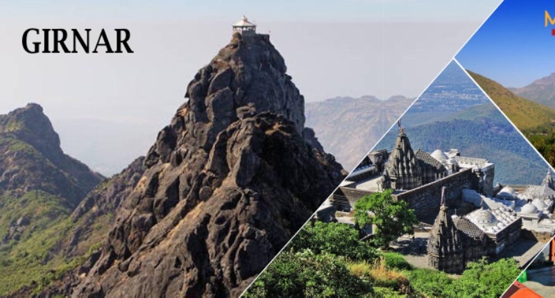
Girnar, also known as Girinagar ('city-on-the-hill') or RevatakParvata, is a group of mountains in the Junagadh District of Gujarat, India.
The Girnar mountain ranges are considered to be sacred. It is an important pilgrimage site for both Jains and Hindus, who gather here during the Girnar Parikrama festival. Girnar is one of the five major 'tirthas' attributed to the 'panchkalyanakas' of various 'Jain tirthankaras'
This mountain was considered holy to Buddhists.
Mount Girnar is a major igneous plutonic complex which intruded into the basalts towards the close of the Deccan Trap period. The rock types identified in this complex are gabbros (tholeiitic and alkalic), diorites, lamprophyres, alkali-syenites and rhyolites. The parent gabbroic magma is shown to have given rise in sequence to diorites, lamprophyres and alkali-syenites. The rhyolite, though earlier considered a product of differentiation, is now believed to be an independent magma without any genetic link with the gabbro and its variants.
The mountain Girnar is older than the Himalayas and the Jain temples upon it are amongst the most ancient in the country; it is the Nirvan bhumi of 22nd Tirthankara Neminath. It is 3666 feet high, and is one of the most remarkable mountains in India. From the city of Junagarh, which is at an altitude of barely 351 feet only the top of Mount Girnar can be seen, as it has in front of it lower hills, of which Jogniya, or Laso Pawadi, 2527 feet; Lakhshman Tekri, Bensla, 2290 feet high; and Datar, 2779 feet high, are the principals.
Fourteen of Ashoka's Major Rock Edicts, dating to circa 250 BCE, are inscribed on a large boulder that is housed in a small building located outside the town of Junagadh on Saurashtra peninsula in the state of Gujarat, India. It is located on Girnar Taleti road, at about 2 km (1.2 mi) far from Uperkot Fort easterly, some 2 km before Girnar Taleti. An uneven rock, with a circumference of seven meters and a height of ten meters, bears inscriptions etched with an iron pen in Brahmi script in a language similar to Pali and date back to 250 BCE, thus marking the beginning of written history of Junagadh.
On the same rock there are inscriptions in Sanskrit added around 150 CE by Mahakshatrap Rudradaman I, the Saka (Scythian) ruler of Malwa, a member of the Western Satraps dynasty (see Junagadh rock inscription of Rudradaman). The edict also narrates the story of Sudarshan Lake which was built or renovated by Rudradaman I, and the heavy rain and storm due to which it had broken.
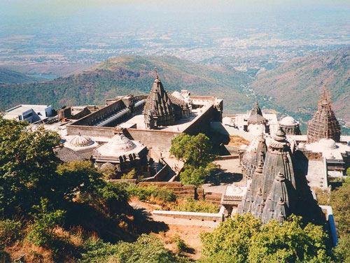
The group temples of Jainism are situated on the Mount Girnar situated near Junagadh in Junagadh district, Gujarat, India. There temples are sacred to the Digambara and the Svetambara branches of Jainism. The temple complex is dedicated to Jainism which is one of the oldest forms of religions existing in the world. The grand temple complex houses several shrines of Jain Tirthankaras with spacious passages, porches and halls atop the Mount Girnar. Devotees who cannot climb up the hills can opt for a palkhi (palanquin) which is readily available from the base of the mountain.
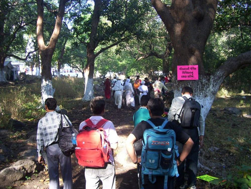
Girnar Parikrama is a massive annual event for Hindus. More than ten lakh pilgrims come to Girnar to carry out the procession. The procession of sadhus and pilgrims begins and ends, at the Bhavanat Temple. This festival takes place on the 11th day of the Hindu calendar month of Kartik. This procession is the backbone of the economy of Junagarh. The importance of GIRNAR PARIKRAMA from the religious point of view is much more. People from all over INDIA come to undertake this tough route, even without bothering about the harsh cold of forest. Here are the individual distances of places located on the app. 36 KM. long parikrama route: ‘Bhavnath’ to ‘Zina Bava Ni Madhi’ = 12 Kms. ‘Zina Bava Ni Madhi’ to ‘Malvela’ = 8 Kms ‘Malvela’ to ‘Bordevi’ = 8 Kms. ‘Bordevi’ to ‘Bhavnath’ = 8 Kms.
Gujarat India
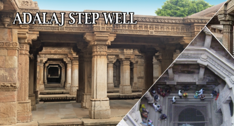
Adalaj Stepwell or Rudabai Stepwell is a stepwell located in the village of
Gujarat India
Saurashtra peninsula is bound on the south and south-west by the Arabian sea, on the
Gujarat India
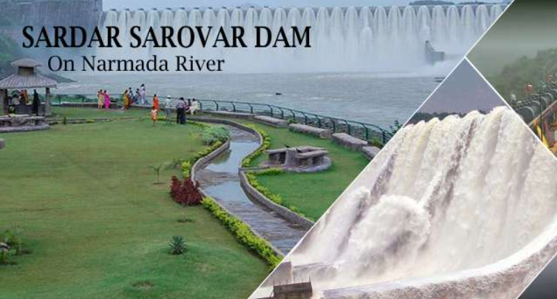
Near Rajpipla, 1163 km away up the river from the sea, is Sardar Sarovar dam. At the
Gujarat India
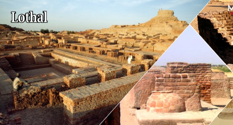
Many great cities of antiquity around the world were the center of their civilization
Gujarat India
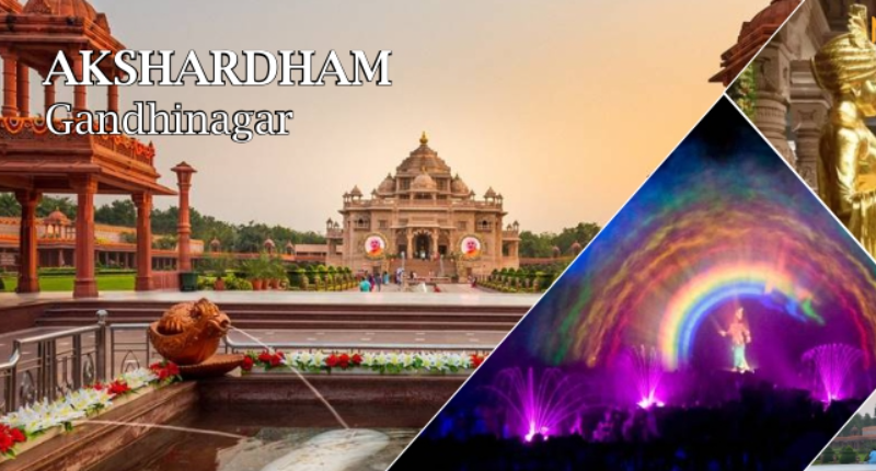
Akshardham is majestic, intricately carved stone structure which stands amid sprawling
Gujarat India
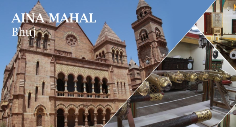
The Aina Mahal palace, or “Hall of Mirrors” was built during the flamboyant
Gujarat India
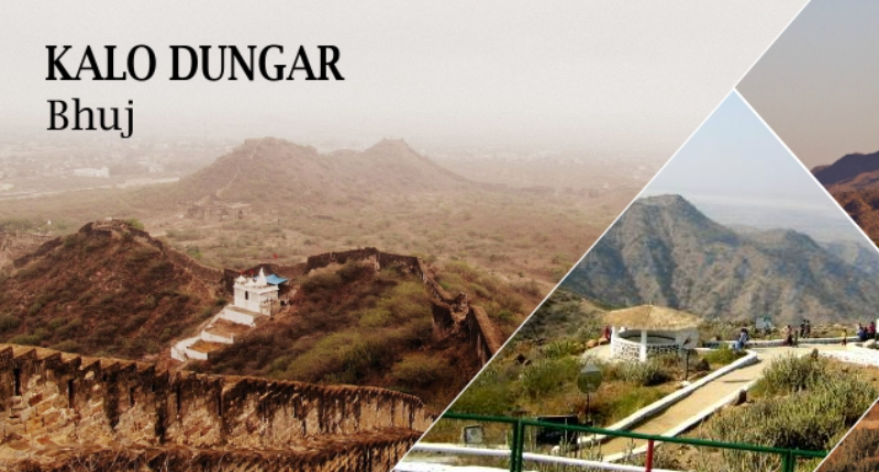
Kalo Dungar calling The Black Hills are 25 kms north of Khavda, the top of the
Gujarat India
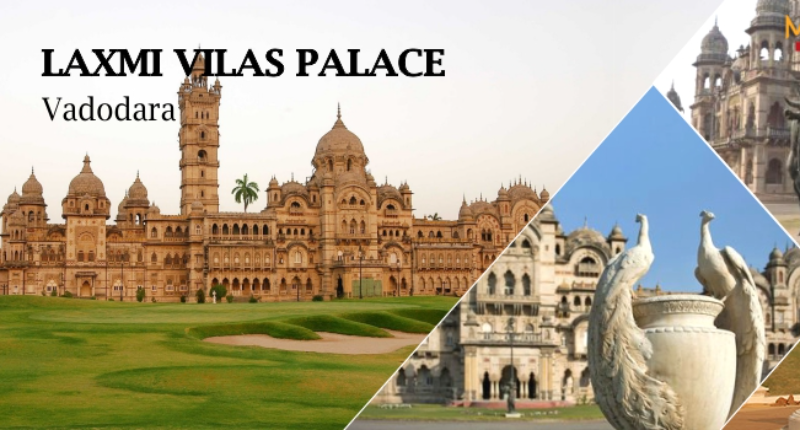
Lukshmi Villas Palace, an extravagant building of the Indo-Saracenic school, was built
Gujarat India
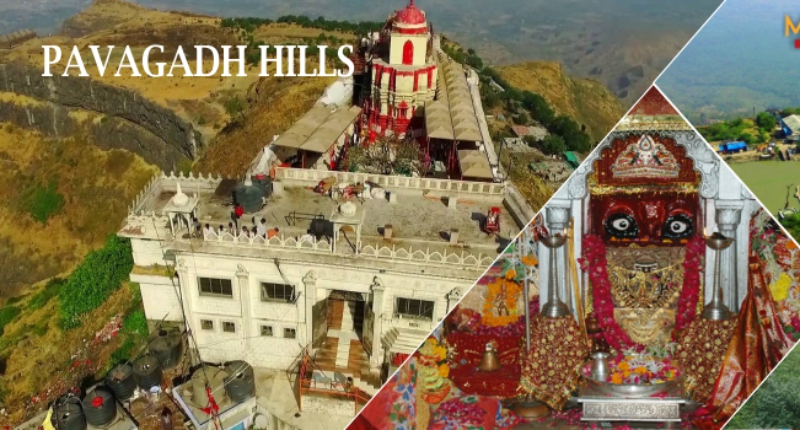
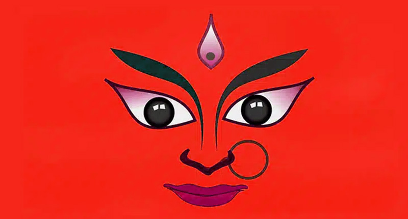
This famous temple of Kali Mata is one of the Shaktipeeths of the mother. Shaktipeeth
Gujarat India
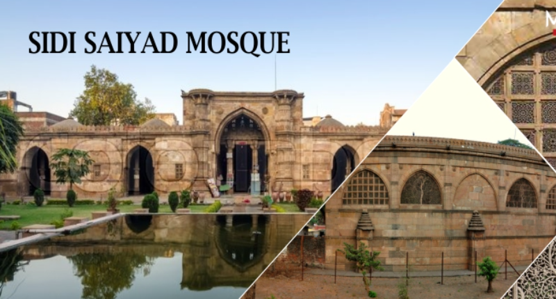
The mosque was built in the last year of the existence of Gujarat Sultanate. The
Gujarat India
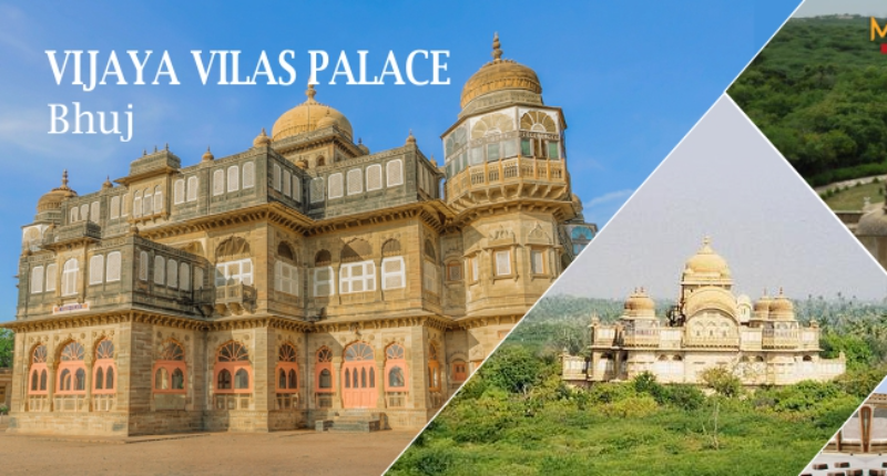
Vijaya Vilas Palace is the famous one time summer palace of Jadeja Maharao of Cutch
Gujarat India
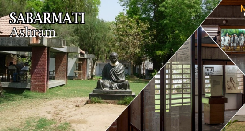
Sabarmati Ashram (also known as Gandhi Ashram, Harijan Ashram, or Satyagraha Ashram) is

Gujarat India
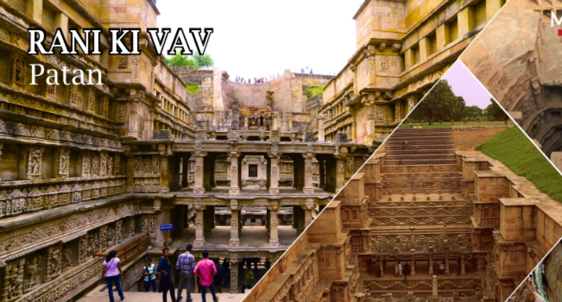
Vanraj Chavda had founded A?ahilpur Patan in 802 CE as capital of his state. Capital

Gujarat India
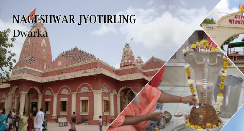
Located on the route between Dwarka city and Beyt Dwarka Island on the coast of
Gujarat India
The story behind the 51 Shakti Peethas is rooted in Hindu mythology, specifically in


