- +91 9428399374
- info@mybesttrip.in
Gujarat India
Longitude : 23.0063 N
Latitude : 72.6026 E
Website : http://www.kankarialakefront.in/
Email : kankarialake.amc@gmail.com
Phone : 91 79 25472444
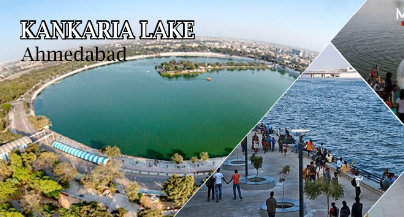
Kankaria Lake is the second largest lake in Ahmedabad, Gujarat, India. It is located in the south-eastern part of the city, in the Maninagar area. It was completed in 1451 during the reign of Sultan Qutb-ud-Din Ahmad Shah II though its origin is placed in the Chaulukya period sometimes. A lakefront is developed around it, which has many public attractions such as a zoo, toy train, kids city, tethered balloon ride, water rides, water park, food stalls, and entertainment facilities. The lakefront was revamped in 2008. Kankaria Carnival is a week-long festival held here in the last week of December. Many cultural, art, and social activities are organised during the carnival.
Several stories are told for its name Kankaria. One reason said is that it was named this due to large quantities of limestone (kankar in Gujarati) dug out of it during excavation. Another story narrates that the Sultan Qutb-ud-Din asked the saint Shah Alam to select the site for the tank and the garden. The saint scattered some pebbles at the site which was excavated and the lake was built. Thus it was named Kankaria. Another story says the saint Hazrat-i-Shah Alam cut his foot on a pebble while passing through excavation and exclaimed, "What a pebble!" So it was named Kankaria (pebbly). It was mentioned as Hauj-e-Qutb (the tank of Qutb) after the Sultan Qutb-ud-Din in the inscription at Kankaria.
There are various versions of its origin. According to the 14th century chronicler Merutunga, Chaulukya ruler Karna built a temple dedicated to the goddess Kochharba at Ashapalli after defeating the its Bhil chief Asha. He also established the Karnavati city nearby, where he commissioned the Karneshvara/Karnamukteshwara and Jayantidevi temples. He also built the Karnasagara tank at Karnavati next to Karneshvara temple. Karnavati is identified with modern Ahmedabad and Karnasagar tank is identified with Kankaria lake but this identification is not certain.
The construction of the lake started by Sultan Muizz-ud-Din Muhammad Shah II in the 15th century. The inscription at the lake mentions that it was completed during the reign of Sultan Qutb-ud-Din Ahmad Shah II in 1451. According to this inscription, its name is placed as "Hauj-e-Qutb" (Pond of Qutb) after him.
Throughout the period of the Gujarat Sultanate and of Mughal rule, the Kankaria lake with its Nagina Bagh were the favourite leisure place of rulers and the people and it were among the tourist sights of Ahmedabad ever since. The European travellers of the seventeenth century, Pietro Della Valle (1623), Johan Albrecht de Mandelslo (1638), Jean de Thévenot (l666), all had visited the lake gave its accounts. Mandelslo who visited Gujarat during the reign of Shah Jahan wrote in 1638 about Kankaria Lake in his book.
British artist James Forbes visited Ahmadabad in 1781 after the fall of Mughal Empire when Ahmedabad was under Maratha rule. He found the gardens at lake neglected, the summer-palace in ruins and the bridge with 48 stone arches connecting Nagina Baug island to the bank in dilapidated condition. He specially noted a species of palmyra in the Nagina Baug which is very uncommon. The tree grown in a straight stem very high and then spreading several branches of with a tuft of spreading leaves at the end of each branch. It is still there. After a century, when Ahmedabad was under the British rule, the Kankaria lake was restored by the Collector of the district, Borradalle in 1872. A road was built from the Raipur gate to the lake. The high banks of the lake were organised and the trees were planted on them. Of the original arched bridge, a small portion was restored and the rest of length is made with earthen bank. In the island, the steps were restored on all four sides, the ancient well was cleared out, the fountain and the pleasure house were restored. the new pierced parapet wall built. In 1879, it was proposed to connect the lake with Khari river by 11 miles long canal and supply water to Chandola lake but it never materialised.
In 1928, Kankaria was declared protected under the Ancient Monuments Preservation Act.
The central garden and the walkway had been revamped and utilities are enhanced by Ahmedabad Municipal Corporation in 2007-2008. Upon completion of the renovation at the cost of INR 30 crore, the lake was officially inaugurated on 25 December 2008 in a week long event known as Kankaria Carnival.
The reservoir is a 34-sided regular polygon covering an area of 76 acres and having a shore length of approximately one and a quarter mile, or 2 km. It is surrounded by flights of cut stone steps and in six places, slopes, giving access to the water. These slopes were covered by square cupolas, each raised on 12 pillars.
n island in the centre of the lake contains a garden and is called Nagina Wadi, formerly Bagh-e-Nagina (beautiful garden in Urdu); it is connected to the bank by a bridge, originally of 48 arches. The garden is mentioned in Mirat-e-Ahmadi as "the Jewel (Nagina) in the centre of the ring of lake". The garden contains a pleasure house or summer palace called Ghattamandal. During restoration, the British constructed a parapet wall around the garden.
The lake had a water purification system which is lost now. There are well carved supply sluices on the east side. Their buttresses or jambs of sluices resemble those of the minarets of mosques in Ahmedabad. Between these buttresses, there is a screen six feet thick screen punctured by three large openings for inflow of water. These openings are six feet in diametre and the margin of it is beautifully carved.
Gujarat India
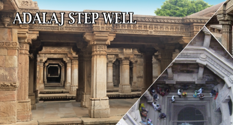
Adalaj Stepwell or Rudabai Stepwell is a stepwell located in the village of
Gujarat India
Saurashtra peninsula is bound on the south and south-west by the Arabian sea, on the
Gujarat India
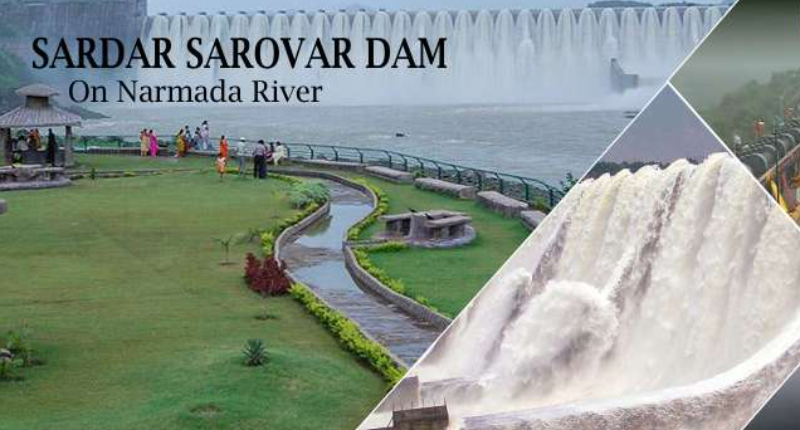
Near Rajpipla, 1163 km away up the river from the sea, is Sardar Sarovar dam. At the
Gujarat India
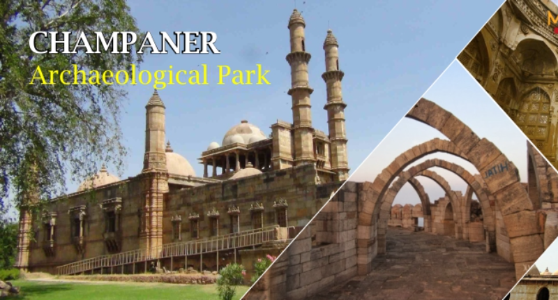
Many great cities of antiquity around the world were the center of their civilization
Gujarat India
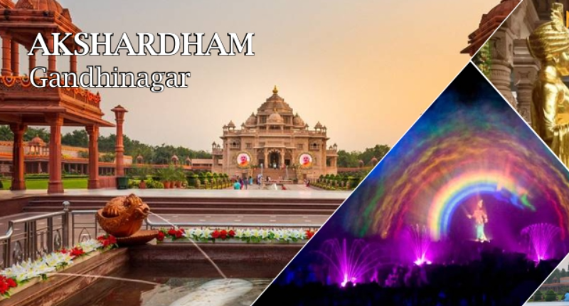
Akshardham is majestic, intricately carved stone structure which stands amid sprawling
Gujarat India
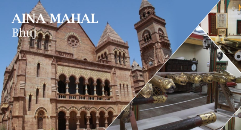
The Aina Mahal palace, or “Hall of Mirrors” was built during the flamboyant
Gujarat India
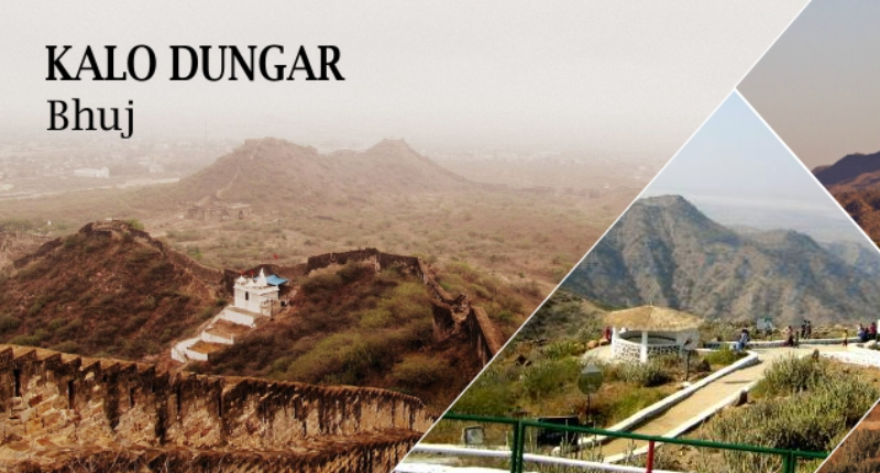
Kalo Dungar calling The Black Hills are 25 kms north of Khavda, the top of the
Gujarat India
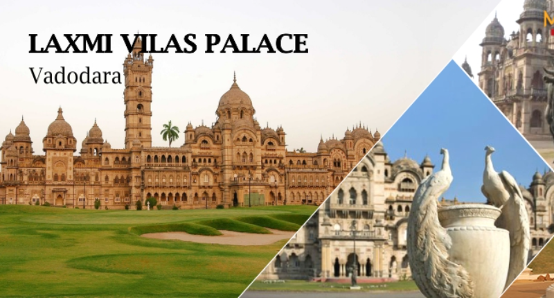
Lukshmi Villas Palace, an extravagant building of the Indo-Saracenic school, was built
Gujarat India
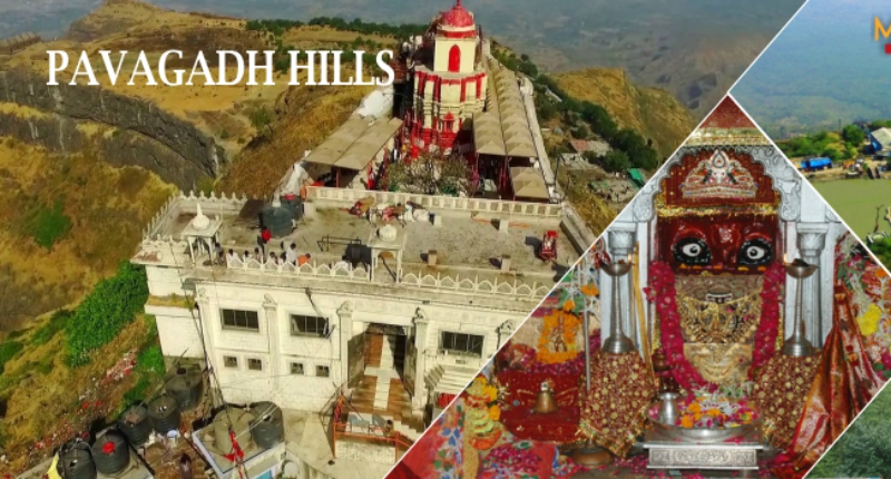
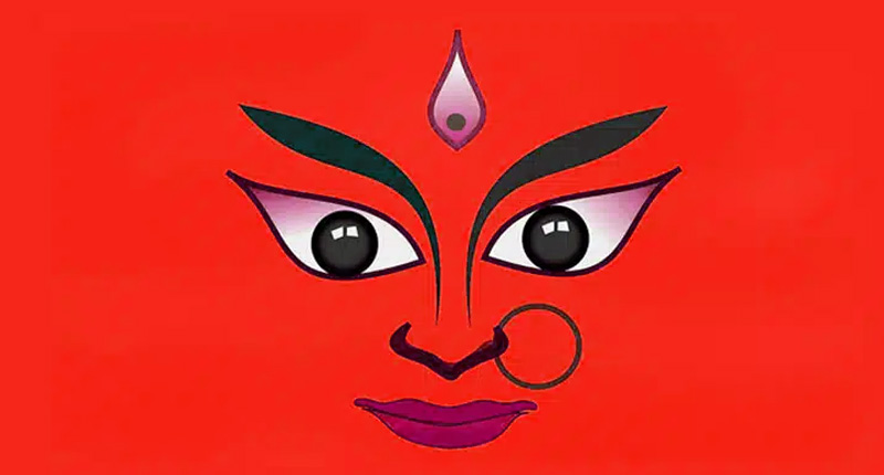
This famous temple of Kali Mata is one of the Shaktipeeths of the mother. Shaktipeeth
Gujarat India
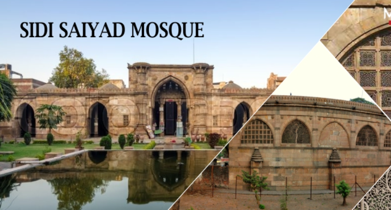
The mosque was built in the last year of the existence of Gujarat Sultanate. The
Gujarat India
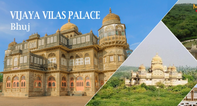
Vijaya Vilas Palace is the famous one time summer palace of Jadeja Maharao of Cutch
Gujarat India
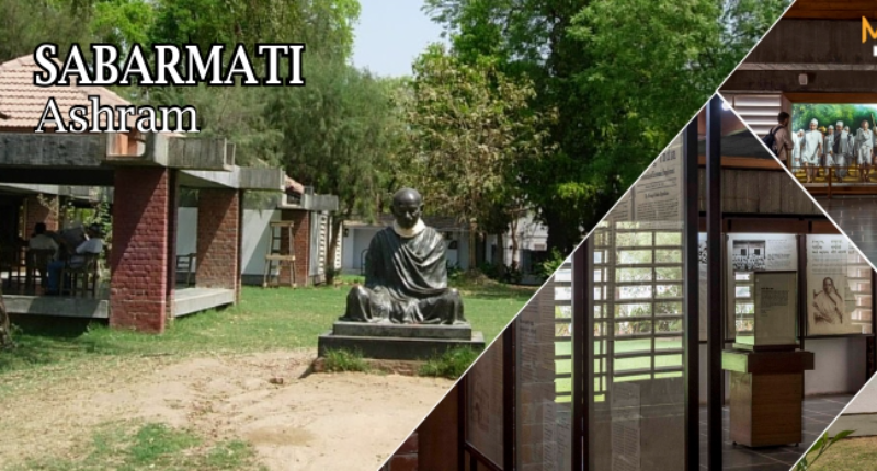
Sabarmati Ashram (also known as Gandhi Ashram, Harijan Ashram, or Satyagraha Ashram) is

Gujarat India
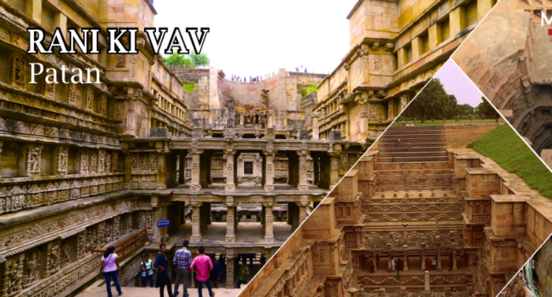
Vanraj Chavda had founded A?ahilpur Patan in 802 CE as capital of his state. Capital

Gujarat India
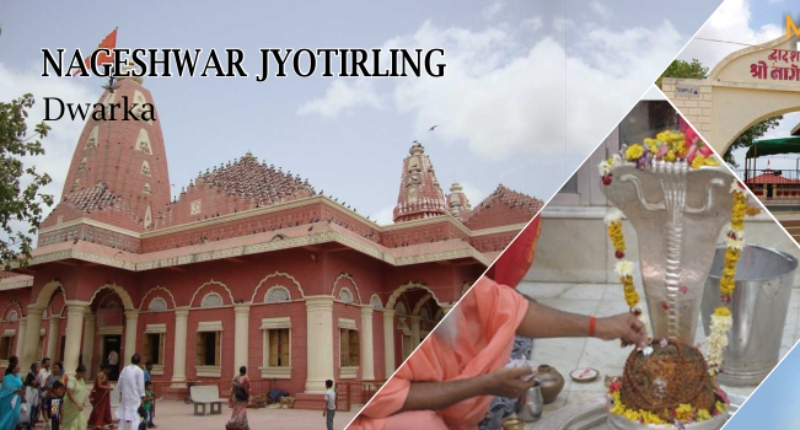
Located on the route between Dwarka city and Beyt Dwarka Island on the coast of
Gujarat India
The story behind the 51 Shakti Peethas is rooted in Hindu mythology, specifically in


